Ryan's Awesome Cardigan Mountain Trip
September 29 - October 1, 2019
By Ryan S.
Yellow Group, D2B2

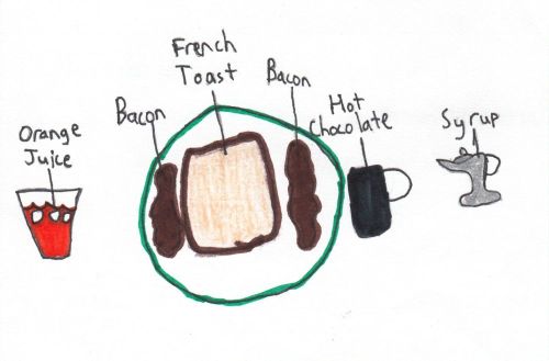
Breakfast at the Appalachian Mountain Club's (AMC) Lodge.
Location of Cardigan Mountain
By Ryan S.
Yellow Group, D2B2

The physical description of Cardigan Mountain is this: There were a lot of trees at the bottom, and the higher up you go, the less trees there were. It was colder the higher up you climbed. Surprisingly, Cardigan Mountain isnít high enough for your ears to pop. There was a fire on top of Cardigan Mountain. It started on Firescrew, and slowly spread onto the summit of Cardigan Mountain. The few trees that at the summit burned down. The trees on the lower section of Cardigan Mountain regrew. But because the upper section of Cardigan Mountain is mostly rock, the trees couldnít regrow.
At the summit of Cardigan Mountain, there is a fire tower. When there are people on watch, they climb the stairs into the room on the top. At the base of Cardigan Mountain is the Appalachian Mountain Clubís (AMC) lodge. There is an abandoned shack on the Holt Trail. On the way up, there are rocks and logs making drains in the trail so that they donít flood. On one of the trails, there is a Cellar Hole. People built stairs on the trails at the steep parts so that people can climb that part easier.
On Day 1 , my hiking group did a short hike during the day and a game at night. On Day 2 , my hiking group drove around Cardigan Mountain and hiked to the summit of Cardigan Mountain. On Day 3 , my hiking group did a pond study. I got stung by two yellow jackets.


This work is licensed under a Creative Commons Attribution-NoDerivatives 4.0 International License.